Project Background
A scenic area in Hunan Province required a comprehensive drone defense system to protect visitors, staff, and sensitive zones from unauthorized UAV activity. The site spans a large outdoor area with varied terrain, including open viewing platforms, forested paths, and crowded visitor hubs. The defense strategy combined fixed detection, handheld detection, and fixed navigation spoofing. The objective was to establish layered airspace awareness and a non-kinetic response capability that could operate without disrupting the visitor experience or local communications.

Operational Challenge
Scenic areas present unique counter-drone challenges. The protected area is large and irregular, with multiple entry points and limited fixed infrastructure. Drones may approach from any direction, and operators must distinguish between unauthorized UAVs and permitted aerial activity. The site also needs to avoid interference with public communications and maintain a safe environment for visitors. A single detection method is insufficient. The security team required wide-area monitoring, mobile patrol capability, and a precise mitigation option that could guide threats away rather than simply dropping them.
Solution Overview
The project deployed three complementary products across the scenic area.
Fixed Detector ETLD02FDA — 2 units
The ETLD02FDA provides 360-degree detection coverage with a range of 5 to 10 kilometers. It covers standard bands including 2.4GHz, 5.8GHz, 800MHz, and 900MHz, with optional 433MHz, 1.4GHz, and 5.2GHz. The unit supports target direction finding with accuracy of ≤15 degrees and parses DJI Drone ID and standard Remote ID protocols. This gives operators drone model, real-time coordinates, and pilot location. A black and white list function allows authorized drones to be ignored while focusing on real threats. Multiple units can be networked via cloud server for wide-area coverage. The device measures 371mm x 338mm and weighs 12kg, built for outdoor industrial environments.
Handheld Drone Detector ETLD-DDH1B — 10 units
The ETLD-DDH1B is a passive detection, identification, and direction-finding device designed for patrol teams. It uses spectrum sensing and AI to classify UAVs and displays sorties, model, brand, and working frequency in real time. Supported targets include DJI series, FPV, FEMI, YUNEEC, AUTEL, HUBSAN, Powervision, Tello, and video transmission modules. Recognition time is ≤2 seconds. Omnidirectional detection range is 0–800m, while directional detection and DF range is 100–2000m. The unit weighs 800g, has IP65 protection, and provides ≥6 hours of battery life. It can work alone or be assembled on a jammer gun for cooperative operations.
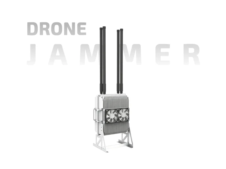
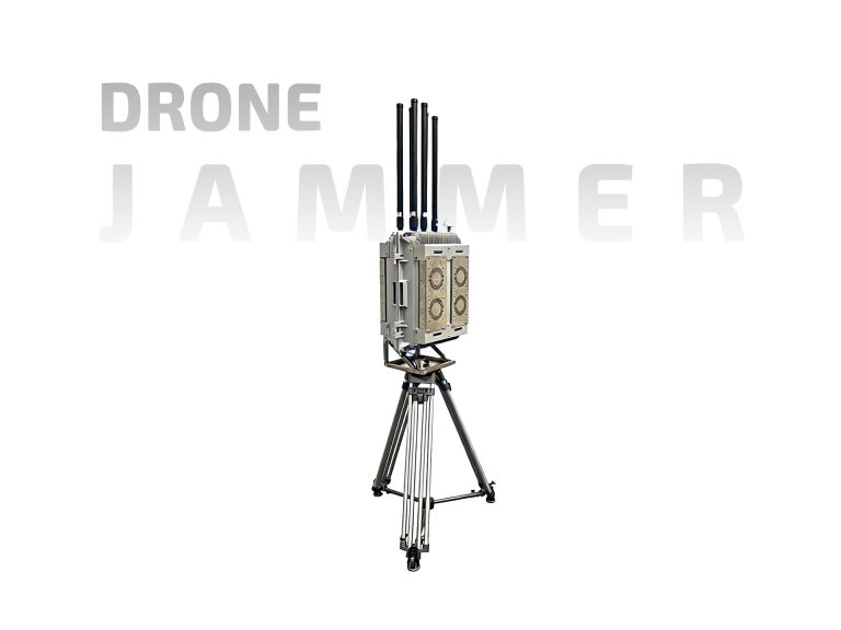
Fixed Navigation Spoofing ETLDD1000 — 2 units
The ETLDD1000 generates fake navigation signals that mimic real satellite transmissions. Standard frequencies include BDS-B1I, GPS-L1 C/A, GLONASS-L1, and Galileo-E1, with extensive optional frequencies available. Spoofing range is 0.5–1km. The system can manipulate drone positions, speeds, and timing, forcing unauthorized drones to land, driving them away from restricted zones, or executing precise point landings. It supports multi-mode spoofing, including circular, straight-line, and complex curve trajectories. The unit integrates with spectrum detection, jamming, and radar systems for closed-loop response. Multiple units can be networked for zonal defense. Dimensions are 411mm×411mm×370mm, weight 15kg.
Deployment and Integration
The deployment was planned around the scenic area’s geography and visitor flow. The two ETLD02FDA fixed detectors were positioned at elevated points to maximize 360-degree coverage across the main visitor zones and approach paths. The ten ETLD-DDH1B handheld units were issued to patrol teams for mobile monitoring along trails, entrances, and crowded areas. The two ETLDD1000 spoofing units were installed to cover critical restricted zones, providing a precise mitigation option when unauthorized drones were confirmed.
Integration focused on coordinated operation. The fixed detectors provide wide-area early warning and direction finding. Handheld detectors allow patrols to investigate and confirm threats at closer range. Once a threat is verified, the navigation spoofing system can be activated to guide the drone away or force a controlled landing. The passive nature of the handheld detectors means they do not transmit signals, reducing the chance of alerting drone operators and avoiding interference with local communications.
Operational Results
The integrated system delivered layered airspace awareness across the scenic area. The fixed detectors provided continuous 360-degree monitoring with accurate direction finding and Remote ID parsing, enabling early threat identification. Patrol teams equipped with handheld detectors reported fast recognition times and reliable performance in crowded RF environments. The navigation spoofing units demonstrated the ability to redirect unauthorized drones without collateral disruption to visitor communications or local systems. The combination of detection and spoofing reduced reliance on kinetic or broad jamming methods and supported a measured, controlled response.
Conclusion
The Hunan scenic area drone defense project demonstrates how fixed detection, mobile detection, and navigation spoofing can work together in a complex outdoor environment. By deploying the ETLD02FDA, ETLD-DDH1B, and ETLDD1000, the site achieved wide-area awareness, flexible patrol capability, and precise non-kinetic mitigation. The layered approach supports visitor safety and operational continuity while providing a scalable foundation for future airspace security needs.